Map - Béjaïa (Bejaïa)

Béjaïa (Bejaïa)
Béjaïa (بجاية‎,, ; ), formerly Bougie and Bugia, is a Mediterranean port city and commune on the Gulf of Béjaïa in Algeria; it is the capital of Béjaïa Province, Kabylia. Béjaïa is the largest principally Kabyle-speaking city in the region of Kabylia, Algeria.

The town is overlooked by the mountain Yemma Gouraya, whose profile is said to resemble a sleeping woman. Other nearby scenic spots include the Aiguades beach and the Pic des Singes (Peak of the Monkeys); the latter site is a habitat for the endangered Barbary macaque, which prehistorically had a much broader distribution than at present. All three of these geographic features are located in the Gouraya National Park. The Soummam river runs past the town.

Under French rule, it was known under various European names, such as Budschaja in German, Bugia in Italian, and Bougie in French. The French and Italian versions, due to the town's wax trade, eventually acquired the metonymic meaning of "candle".

 
Map - Béjaïa (Bejaïa)
Map
Google Earth - Map - Béjaïa
Google Earth
Openstreetmap - Map - Béjaïa
Openstreetmap
Map - Béjaïa - Esri.WorldImagery
Esri.WorldImagery
Map - Béjaïa - Esri.WorldStreetMap
Esri.WorldStreetMap
Map - Béjaïa - OpenStreetMap.Mapnik
OpenStreetMap.Mapnik
Map - Béjaïa - OpenStreetMap.HOT
OpenStreetMap.HOT
Map - Béjaïa - OpenTopoMap
OpenTopoMap
Map - Béjaïa - CartoDB.Positron
CartoDB.Positron
Map - Béjaïa - CartoDB.Voyager
CartoDB.Voyager
Map - Béjaïa - OpenMapSurfer.Roads
OpenMapSurfer.Roads
Map - Béjaïa - Esri.WorldTopoMap
Esri.WorldTopoMap
Map - Béjaïa - Stamen.TonerLite
Stamen.TonerLite
Country - Algeria
Flag of Algeria
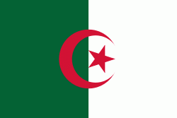
Algeria, officially the People's Democratic Republic of Algeria, is a country in North Africa. Algeria is bordered to the northeast by Tunisia; to the east by Libya; to the southeast by Niger; to the southwest by Mali, Mauritania, and Western Sahara; to the west by Morocco; and to the north by the Mediterranean Sea. It is considered part of the Maghreb region of North Africa. It has a semi-arid geography, with most of the population living in the fertile north and the Sahara dominating the geography of the south. Algeria covers an area of 2381741 km2, making it the world's tenth largest nation by area, and the largest nation in Africa, being more than 200 times as large as the smallest country in the continent, The Gambia. With a population of 44 million, Algeria is the ninth-most populous country in Africa, and the 32nd-most populous country in the world. The capital and largest city is Algiers, located in the far north on the Mediterranean coast.

Algeria produced and is linked to many civilizations, empires and dynasties, including ancient Numidians, Phoenicians, Carthaginians, Romans, Vandals, Byzantines, Umayyads, Abbasids, Rustamids, Idrisids, Aghlabids, Fatimids, Zirids, Hammadids, Almoravids, Almohads, Zayyanids, Spaniards, Ottomans and the French colonial empire, with the latter expanded into its present-boundaries. After 132 years of being part of France, tensions between France and the local Algerian populace led to the start of the Algerian War which concluded with Algeria obtaining its independence on 5 July 1962 with the establishment of the People's Democratic Republic on 20 September of that year.
Currency / Language  
ISO Currency Symbol Significant figures
DZD Algerian dinar دج 2
ISO Language
AR Arabic language
Neighbourhood - Country  
  •  Libya 
  •  Mali 
  •  Mauritania 
  •  Morocco 
  •  Niger 
  •  Tunisia 
  •  Western Sahara